Tuesday, January 27, 2015

Wildlife (thus far)

I’ve been receiving some questions regarding what wildlife I’ve seen so far so I thought I’d dedicate a post to the topic. As I previously mentioned, marine wildlife follows the sea ice edge; on our last helicopter trip back to the base, we followed the sea ice edge (the helicopters are not permitted to operate over open water) which gave me some great marine life sightings. There has also been a substantial amount of melt due to both natural causes and facilitated by the recent docking of the Coast Guard ice breaker (in anticipation of clearing the way for the supply ship).
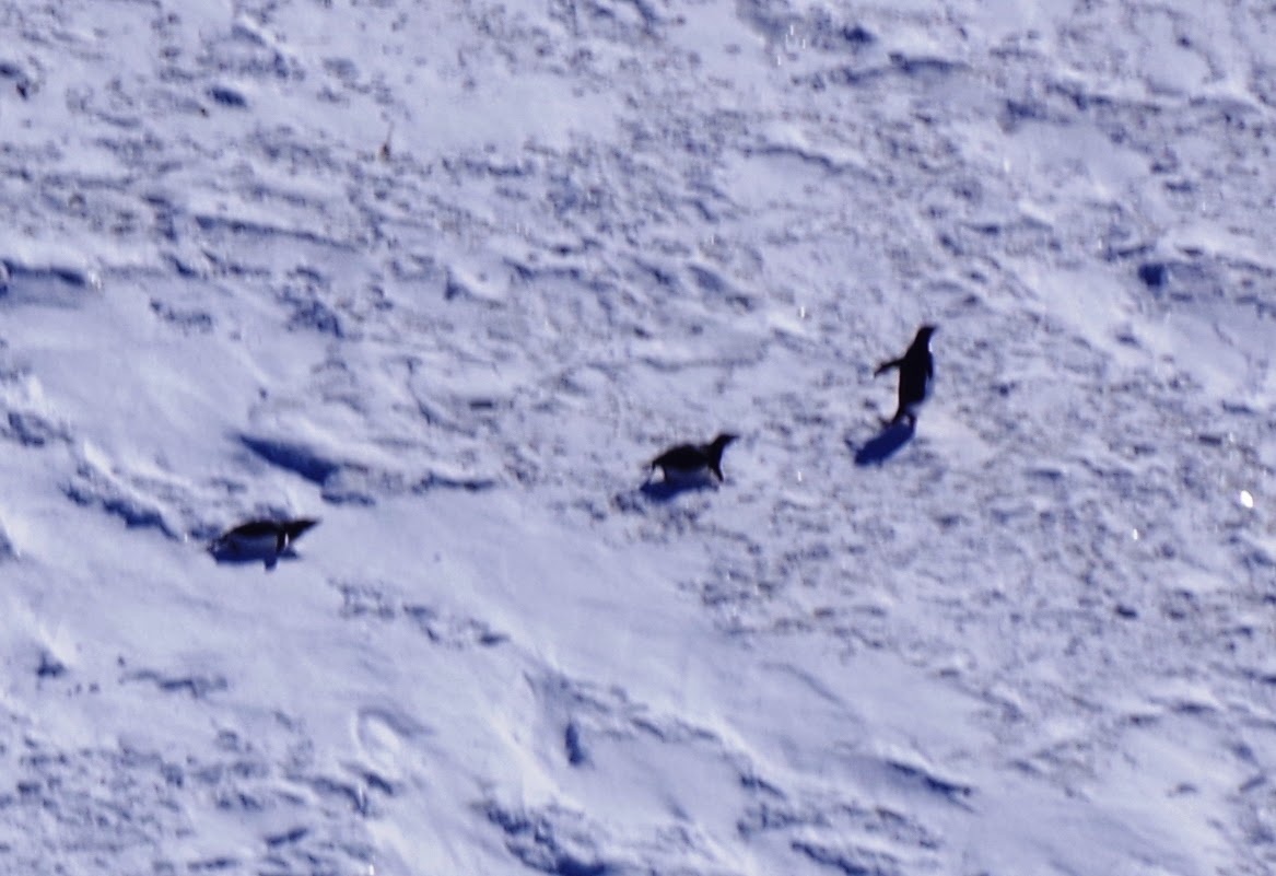
Picture 1: Three adelie penguins on sea ice in McMurdo Sound.

Picture 2: Three orca whales in McMurdo Sound.
Picture 3: Wedell seal lounging on sea ice near Hut Point.
I’ll start with the helicopter ride first. Adelie penguins tend to use the ice edge as a staging ground since they feed off of krill and fish in the surrounding waters (Picture 1). But why is there so much food for them to eat here? While the sea ice is thick (up to 6 ft) it’s still thin enough to allow sunlight to pass through. This allows the growth of primary producers (photosynthetic organisms) both algae in the ice itself and phytoplankton in the area immediately below.  The waters of McMurdo Sound are rich in nutrients so the long hours of sunlight in the summer months can really get the system going in terms of primary production (think of a garden growing with lots of light and fertilizer).  As the season progresses, the ice thins and melts causing the algae to fall out and phytoplankton growth to rapidly increase. This phytoplankton is a main food source for krill, small free swimming crustaceans, which form a significant portion of the Adelie penguins’ diet.

Antarctic minke and orca whales are also present in these waters (Picture 2). While the minke whales eat the plankton and krill, orcas are known to eat penguins and fish. Therefore, they both tend to follow the ice edge as well. While I had heard orcas can often be found in packs, I was still surprised to see so many together. Overall, it made for a pretty eventful helicopter ride.

Picture 4: Emperor penguin near Hut Point in the process
of molting. 
Back at McMurdo, we’ve seen a slow progression of different marine mammals make their way to our area. Wedell seals have been present near the base since I arrived in late December (Picture 3). They can hold their breath far longer than penguins and therefore were seen much earlier in the season along cracks, or pressure ridges, in the sea ice formed by internal stresses. Wedell seals can eat a variety of marine organisms including krill, fish, squid and sometimes even penguins.
Picture #5: Two adelie penguins near Hut Point.

However, with the arrival of the coast guard icebreaker and the subsequent arrival of a research vessel (the Palmer), there is now a decent amount of open water near some portions of the coast line.

Unfortunately, the area of ocean which has opened up is near an area has been off limits to us since Monday morning due to all the activity at the docks associated with the soon to be arriving resupply ship. Since I knew of this cutoff time in advance, I took one last trip out to this area late Sunday night to see if there were any new visitors to the area.  I was pretty surprised with what I found!

Picture 6: Wedell seal swimming near Hut Point.
First, there was an emperor penguin not too far from the shore (Picture 4). The Emperor actually showed up a couple of days earlier and has been sitting patiently ever since. Emperor penguins are a little less common than adelies in this area, but they sometimes follow the open water created by the icebreaker.  Emperor penguins are the heaviest and tallest of all penguin species, sometimes reaching over 3 feet in height. This particular emperor penguin is in the process of molting, or a replacement of its feathers. Each year most penguin species will undergo this process where old feathers which have become worn will be pushed out and replaced. I’ve been impressed with how still this penguin has remained throughout the days only moving to keep its back turned against the wind.

However, on this last trip I also found a couple of new visitors to the area. Two adelie penguins had also made their way in along the new pathway in the sea ice, though they appeared a little more tired from the journey (Picture 5). By this time it was near midnight and I was pretty cold. I was about to head back to the base when I saw something staring at me from the water.  It turns out there was also a Wedell seal in the area (Picture 6). This one seemed to be intrigued by me and stared at me a couple of times while I stood watching.

Picture 7: Minke whale swimming near Hut Point.
It was at this time when I heard what appeared to be a huffing sound and a nearby splattering of water. It turns out a minke whale had also made its way in to the waters near the base! (Picture 7) The minke surfaced and spouted several times near the ice edge likely feeding in this area (While I was able to capture some video of this the internet speed is really slow so I’m only able to upload pictures for the time being). All in all, it was a great day for sightseeing.


Saturday, January 24, 2015

Goodbye to the Dry Valleys

Picture 1: View of the lower portion of Taylor Valley.
The valley floor is approximately two miles wide at this
point. 
On Wednesday morning, my colleague Carolyn and I took one last helicopter ride out to the Dry Valleys to collect additional soil samples for her project. This time we were to land at the F6 campsite, which would serve as our focal point for sampling soils along three watersheds located in the general area. One small caveat to this trip was that we heard beforehand that winds coming off of Taylor Glacier and down the valley had really picked up overnight (40-60 mph gusts). While the majority of our helicopter ride across McMurdo Sound was uneventful, it did make for an interesting final leg of the journey upon entering the valley. I had the front passenger seat of the helicopter this time so it allowed me to get some great photos of the valley (Picture 1), though it was hard to keep the camera level due to the turbulence!

Picture 2: Diagram illustrating katabatic winds in 
Antarctica (Source:Alfred Wegner Institute for Polar
Marine Research).
These winds are a weather phenomenon known of katabatic winds. These winds are common in Antarctica and originate from the build-up of cold dense air over the higher elevated ice sheets.  Periodically these air masses will get dislodged, and due its greater density gravity will propel it down the valley as fast moving winds (Pictures 2 & 3). The air itself generally heats up as it moves downhill and this helps remove any excess moisture near the surface helping to keep the Dry Valleys a desert environment. While katabatic winds can generally be in excess of 100 mph, we were fortunate to experience a milder version.

Picture 3: View towards the west end of Lake Fryxall at the
onset of our hike. Note the low level clouds, which are
associated with the katabatic winds.
Unfortunately, the winds were blowing from the direction of our planned two mile hike to the west of end of Lake Fryxall (Picture 3). In addition to the winds, we were both carrying backpacks with our sampling equipment so this was not going to be an easy trip. We slowly made our way up the valley floor using moraines and large boulders as periodic shelter from the winds. It took us about an hour and half to reach our first destination, Delta Stream (we decided to sample the closer watershed, Crescent Stream, on our return trip). After refueling with some peanut butter and jelly sandwiches we collected our samples and then began our return journey. At first, the wind was at our backs which definitely helped push us along. However, it was while we were sampling Crescent Stream that the winds shifted in a cruel twist of fate; they were now blowing directly from the east. Needless to say we were pretty wiped out when we finally made it back to camp. After taking a little break, we sampled the third and final watershed which was a lot closer to the camp itself. 

Picture 4: Nighttime panorama of the Commonwealth Glacier.


Picture 5: Lower Taylor Valley illuminated by the
nighttime sun.
The last night in the field was bittersweet. We had dinner with members of the "stream team" who were also still staying at the campsite. Later in the night, I decided to take one last night in the Dry Valleys. While I will leave the valleys with many memories, one of my favorites is seeing the landscape in the eerie nighttime sun (Pictures 4 & 5). As I previously mentioned, the different direction of sunlight illuminates the landscape in a unique way often revealing secrets that were hidden in plain sight. I hope I can do the same with the samples I collected and add to our overall understanding of how sediments and elements are transported in this unique system. But for now, I decided to just take it all in one last time. While I may never get to see this part of the planet again, I'm extremely grateful to have had this field experience. 

Tuesday, January 20, 2015

Blood Falls

Picture 1: View of open water to the north in McMurdo 
Sound.

Picture 2: View of the Ferrar Glacier. The glacier occupies
 the valley immediately to the south of Taylor Valley.
It was nice to catch the last helicopter flight back into McMurdo Saturday evening as it allowed me to get a warm shower and an actual bed for a night before heading back into the field on Monday morning.  There was a noticeable change since the last time I took this flight across the sound.  The edge of the sea ice was clearly visible a couple of miles to the north due to additional melting during these summer months (Picture 1).  Last year there was a substantial amount of sea ice melt and the area in front of McMurdo was completely ice free. This would be great if it happened again because you are able to see whales and adelie penguins when the ice retreats close to the base. Stay tuned!

The Monday morning of my flight back out to the Dry Valleys was probably the clearest day since I’ve been here.  This allowed us to take an uncommon, but highly scenic route to the Dry Valleys.  Upon crossing McMurdo Sound, we took a diagonal flight path across Ferrar Glacier and the Kukri Hills (a mountain range with peaks over 6000ft) to reach the upper end of Taylor Valley (Pictures 2 &3). Both provided spectacular views making this one of the most memorable flights I have ever taken.

Picture #3: View of the Kukri Hills range.
Picture 4: View of Blood Falls.
Our first destination was Blood Falls. This geologic feature is located along the eastern edge of Taylor Glacier and essentially marks the upper end of the unglaciated portion of Taylor Valley (Pictures 4&5). While I have previously seen pictures of this peculiar feature, I was not prepared for its size it is equivalent in height with a five story building! Blood falls gets its appearance from dissolved iron that is being discharged in brines, water that is saltier than the ocean, from the base of the glacier. When in contact with oxygen near the surface the iron oxidizes or reacts with oxygen to form this reddish color material. It is believed this brine was deposited during a previous interglacial period when temperatures where warmer than they are today and a relatively higher ocean filled much of the Taylor Valley and abutted the glacier itself.  It is not yet known what controls the periodic flow from Blood Falls. At the time of our visit it was not flowing so we were only able to see the iron oxide deposits.

Picture 5: Closeup of the iron oxide deposits located at the
base of Blood Falls.
After taking in the sights, it was time to get to work. This trip was a little different than the last one because I was in the role of field hand. Helping others with their research projects is quite normal in the Dry Valleys because projects can be labor intensive, the overall field season is limited time wise due to climate, and you are not allowed to enter remote areas of the field by yourself for safety purposes. 

Therefore, my job today was to assist Dr. Carolyn Dowling, a geochemist from Ball State University in Muncie Indiana (Picture 6). Carolyn is looking at the relative chemical weathering of the soils in Taylor Valey, in other words the of amount chemical alteration that has occurred solely due to the interaction of water with the minerals in the soil. As I previously mentioned water can be a precious commodity in the Dry Valleys; therefore, the longer a soil has been present the more 

Picture 6: View of Dr. Carolyn Dowling and D. Berry
 Lyons hard at work in the field.
Picture 7: View of me sampling Lawson Creek.
extensively it is to have been chemically altered. It is this potential linkage between time and chemical weathering that forms the basis of Carolyn’s project. In each of her sites we collected soils in a transect, or straight line moving directly out from the stream bed. This will allow her to see how shallow groundwater near the stream is also influencing how minerals weather.

An added bonus of this trip was the fact that I got to join a long-term research mentor of mine in the field, Dr. Berry Lyons of The Ohio State University… or should I say the home of the 2015 National College Football Champions!  Dr. Lyons served on my PhD committee at Ohio State and was the one who invited me down here to conduct research in the Dry Valleys (Picture 6). Berry has over 20 years of field deployments in the Dry Valleys so I was excited to ask him questions about so many features and processes in the valleys while we were both witnessing them firsthand. I also appreciated his updates of many individuals I had known from Ohio State and what their projects entailed.

We made a total of two planned stops which also allowed me to collect spot or one-time suspended sediment samples from four different streams, thus adding to my dataset for the year (Picture 7). Unfortunately, it was during our time walking around this second stop that we learned that a storm had moved into McMurdo rather suddenly, which meant that this would not be a day trip after all (This has definitely been an unpredictably stormy and cold season). Fortunately, the Lake Hoare campsite was not too far away and we had a place to stay for the evening. While it meant another night in a tent, it also meant the likelihood of another great meal. We were also joined by several other scientists stranded by the weather. In all, there were a total of 19 people staying at the small campsite. Again, we all made the most of it and had a great evening together. 

Wednesday, January 14, 2015

A Change in Scenery and a Change in the Weather

Picture 1: Snowfall at the Lake Hoare campsite 
Picture 2: View of snowfall looking up-valley of he Lake
Hoare Campsite. 
As the saying goes, all good things must eventually come to an end.  The good news is I finished my second diurnal (24 hour) sampling of Anderson Creek.  However, the weather has been slowly getting colder by the day, which has definitely lowered streamflow in the area.  It’s been really interesting to watch this steady downward progression in temperature (the average daily high temperature is now in the low 20s instead of low 30s).  While some of it is due to the frequent cloudy skies of late, it is ultimately the result of the decrease in solar radiation as we move away from the austral summer solstice.  It’s pretty amazing to experience firsthand an environment slowly shutting itself down for the season.

Two nights ago, I woke up in my tent to the sound of howling winds. It’s a little disconcerting when you feel your tent shaking, but the wind was then followed by a sound which made it seem like the tent was being pelted by sand. I unzipped the tent door to discover it was snowing (Pictures 1&2)! I was supposed to be taking a helicopter ride to my next field site, but the helicopters that transport scientists to different locations throughout the Dry Valleys do not operate in these conditions. This delay was actually a welcome relief in some ways as it let me stay an extra day at the Lake Hoare campsite. I really enjoyed my time there, especially solving crossword puzzles with Rae and Rene during our free time.  They run a great camp that is a welcome reprieve from sampling.

Picture 3: View of the upstream portion of the Von Guerard 

watershed. Crescent Glacier is located to the right..
Yesterday, the weather improved and my helicopter arrived and transported me to my second field site F6.  Here, I will be sampling Van Guerard stream for its suspended sediment concentrations as well.  As an addition to the study, I’ll also be collecting separate samples for a colleague who is interested in determining the amount of atmospheric pollutants from other parts of the world that make their way down here and are deposited on glaciers.

There are some differences between Van Guerard and Anderson streams. The former is a much longer river whose source waters are from two glaciers instead of one (Crescent Glacier and an unnamed glacier to its east) (Picture 3).   

Picture 4: View of water tracks in the Dry Valleys.
There are also differences between the campsites. F6 is a lot more crowded than Lake Hoare, as there are many different research teams working in the area (16 people as I write this).  I was introduced to members of one group who call themselves the wormherders. These individuals are researching nematodes, small roundworms that live in Antarctic soils in the Dry Valleys. The nemotodes graze on yeast, bacteria, fungi and the microscopic life in the soil. The scientists are studying whether increasing the amount of carbon, phosphorus, and/or nitrogen will lead to an increase in food for the nemotodes and affect their overall metabolism. Another group is using the area as a base camp for studying water tracks along the surface of the soils (Picture 4). These features are superficial landforms that are created by the downslope movement of water originating from groundwater seeps. The ground water is ultimately sourced from the seasonal melting of permafrost, glaciers, and snow.

Picture 5: View of the F6 campsite with its many tents.
While many people in tight shared quarters can potentially lead to tension, everyone here has clearly made the best of the situation. We all chip in with the cooking and chores. There also appears to be a morning tradition of everyone participating in a group version of Wii’s Just Dance to get the blood flowing after a cold night.  Needless to say I didn’t do so well on the first day but I enjoyed myself.


Monday, January 12, 2015

Ventifacts and More!

Picture 1: Uneven ice surface on Lake
Chad.   
Venitfact - any stone shaped by the abrasion on windblown sand (Webster’s Dictionary)

After a long work week at Lake Hoare it was time for a little fun. I decided to go on a six hour hike that would take me down the shoreline of Lake Hoare and its western counterpart Lake Chad, around Suess Glacier, and then finally up a steep slope to a ridge in order to see some unique geological features called ventifacts.

Hiking in the Dry Valleys isn’t as easy as it is back in the states. Surfaces are often uneven and comprised of material called till, which is loose rocks and sediment left behind on the surface after periods of glaciation. Walking on this material definitely slows down your travel time and can wear out your legs if you’re not mindful to take regular stops. However, the views are definitely worth it once you get going.

Picture 2: View of Lake Chad from the west.  
As I made my way down Lake Hoare and Lake Chad, it was neat to observe the ice features on the surface of the lakes (Pictures 1 &2).  Preferential melting, wind erosion of ice, and movement of the underlying lake water all contribute to these unique patterns on its surface.

Picture 3 Scalloped features in the glacier ice.
Next up on the journey was Suess Glacier. I needed to walk around the glacier to get to my final destination and I found a nice path between the glacier itself and its terminal moraine (A terminal moraine is a mound of till that is pushed up in advance of a glacier as it moves across the landscape).  It was impressive to be so close to the edge of the glacier and observe features such as frozen waterfalls, scalloped patterns in the ice, and melt water streams (Pictures 3 &4). I was also impressed with its overall size as in some locations the ice face was the height of a five-story building!

After rounding the front of glacier, I made my way up a steep hill which provided some great views of Seuss Glacier (Picture 5). It was nice to stop and take in the vastness of the landscape and the sounds of the wind. It was definitely the most isolated I’ve ever felt from human contact, which was also good motivation to keep moving.

Picture 4: View of an ice waterfall located along the front
face of Suess Glacier.
Upon summiting the ridge, I was greeted by one of many ventifacts (Pictures 6-9). The ventifacts consist of boulders that are frequently subjected to high winds. These winds routinely pick up sand grains which scour the exterior of the rock. In some cases this erosion can leave behind smooth polished surfaces while in other cases there appears to be arms extending from the boulder itself.  The wind was really gusting along the ridge and it was snowing so I didn't stick around too long after taking some pictures.

Picture 5: View of Suess Glacier from the opposing ridge.
The return trip allowed me to take in the same sights form a new direction.  I frequently found myself looking at the edge of the lakes which had melted for signs of fish or other forms of aquatic life. It’s an eerie feeling to be an environment almost completely devoid of life forms you can see with the naked eye. It was at this time I was greeted by Taylor, the resident skua (an Antarctic bird) of the valley. It was nice to have this welcome back to camp.

Picture 6: View of a ventifact.


Picture 7: View of a ventifact.

Picture 8: View of a ventifact.

Picture 9: Rock broken apart by freeze thaw action.


Saturday, January 10, 2015

My Experiment

Picture #1: View of Anderson Stream
at Lake Hoare.
Now that you have some background on the Dry Valleys, I thought I would take a little time to talk about my experiment. I’m seeking to determine both the amount and chemical composition of suspended sediments in glacier-fed streams. In case you’re wondering what I mean by suspended sediments, it refers to the particulate (= not-dissolved) material that can be carried by a stream. This is the material that can often give streams a brownish color during storms. There is little to no data on suspended sediment loads and chemistry of Dry Valley streams, so I am excited to contribute something new to our knowledge of these systems.

While glaciers may look like pure compressed snow and ice in appearance they actually carry a substantial amount of sediment.  In the case of these Taylor Valley glaciers, much of this material likely originates from windblown dust within the valley along with some potential contributions of ash from Mt. Erebus, a nearby volcano.  However, it is unclear as to whether these are the only two sources of sediment. 


Picture #2: View of VanGuerard Stream at F6
Picture #3: View of gauge located along Anderson Stream.
In order to get a better handle on how suspended concentrations may change over time I designed my study into three parts: (1) periodic sampling of rivers throughout Taylor Valley, (2) daily sampling of two streams of interest (Anderson Stream at Lake Hoare and Van Guerrard at F6), and (3) diurnal (24 hour) sampling of these two streams of interest (Pictures 1 &2). Like many scientific studies, this one definitely requires cooperation.  Samples for the first part of the study are collected by a group known as the “stream team.” This is a rugged bunch of individuals who often hike to several locations in one day in these valleys to collect samples (Lucky for me they agreed to collect additional samples for my study). Samples for the second part the study, the daily sampling, are collected by the respective camp managers for Lake Hoare and F6 (Again, I’m indebted to their generosity).  It’s the third part of the study that fully occupies my time in the field due the intensive time required. 

For diurnal sampling, you’re basically trying to understand how a system, in this case a stream, operates during the course of a day.  While it doesn’t necessarily matter when you begin sampling, it does require you to sample frequently over a 24 hour period. 

Picture #4: View of filtering equipment in the mini-lab
at Lake Hoare.
In order to have some idea as to how much suspended sediment might be moving down a stream, you need to know the concentration of sediment in the water as well as how much water is moving down the stream at any given time. For the latter, I purposefully chose locations where stream gauges, or devices used to record stream flow are already located (Picture 3).  Therefore, my job is to collect water samples by hand at each sample interval to determine sediment concentration.  One catch is that in order to retrieve enough suspended sediment to analyze for its chemistry I need to collect 10 liters of water (Picture 4). That’s basically the equivalent of 2 1/2 gallons of water!

To date, I finished one diurnal sampling of Anderson Stream, which is loc
ated adjacent to the west side of Canada Glacier.  Although the sun shines all day at this point in the year, its relative height and position change throughout the course of a day.  The unique conditions for this area of the valley cause a peak in streamflow around 4pm and another one around 11pm. The lowest flows are recorded in the morning. Therefore, I spread my sampling intervals out during the morning low-flow period. However, from 4pm to 4am I collected samples every hour.  I subsequently brought these samples to the small lab shed where I’ve been patiently filtering ever since!
Picture #5: View of the drainage patterns in Canada Glacier
 illuminated by the nighttime sun.


The one really neat thing about staying up so late to sample is that you get to see the sun hit the landscape in unique ways. Views that seemed ordinary at first suddenly appeared unworldly.  In some cases, this different illumination of the landscape yielded very important information, such as the appearance of what looked like tiny streams with tributaries draining Canada glacier! (Picture #5) Overall, it gave me the distinct feeling that I was working on an alien planet.

Wednesday, January 7, 2015

The Dry Valleys

Picture 1: Map of the Dry Valleys. The Lake Hoare and F6
campsites in Taylor Valley are shown with stars.
Picture 2: View of Taylor Valley.
The McMurdo Dry Valleys are a series of ice-free elongate valleys located approximately 50 miles across McMurdo Sound from our current location (Pictures 1&2). The Valleys increase in elevation as you move away from McMurdo Sound, and the upper ends of the valleys are occupied by glaciers. These mountains were initially formed during the late Mesozoic Era (~135-180 mya), when Antarctica broke away from other continents and began its southward trajectory to its current location. These mountains are particularly important because they have largely diverted ice flows from the Antarctic continental ice sheet around this area, thus keeping the valleys ice-free. However, during previous glacial periods, glaciers extended well into the valleys and carved them out into their present form.

The Dry Valleys are considered a polar desert, and are one of the driest places on Earth. One of the primary reasons is because the area receives so little precipitation, the water equivalent of about 5cm a year (less than Las Vegas!). Another reason is because cold winds that originate on the Antarctic ice sheet swoop into the valleys and prevent the chance of precipitation. These unique environmental conditions have existed for hundreds of thousands if not millions of years.

So if it’s so cold and dry how are we able to study streamflow in the Dry Valleys? The answer is a few weeks out of the year a combination of relatively higher temperatures and an increase in sunlight during the summer months initiates melting in the glaciers that are located along the edges of these valleys. This glacial melt water becomes the primary source of streamflow in the Dry Valleys. Another relatively minor contribution to streamwater can come from the melting of permafrost, or frozen water, stored just beneath the surface in the surrounding soils. Therefore, each year’s stream flow is ultimately dependent on the relative warmth of that particular summer.
Picture 3: View of Lake Hoare, one of the many closed basin
lakes located in the Dry Valleys

What has drawn so many scientists to study the Dry Valleys is that they are the closest environment we have on Earth to what we might expect on Mars. It is generally accepted that Mars had significant quantities of water in the distant past. However, for reasons we don’t completely understand, much of this atmosphere is gone and any water is limited to either ice caps at the poles or in the soil as permafrost. This hopefully sounds similar, since it parallels what I mentioned about the primary sources of water in the Dry Valleys. Furthermore, some scientists think the Dry Valleys represent the late stages of water cycle evolution on Mars. With seasonal melting from glaciers or ice caps feeding closed basin lakes (Picture 3).

Picture 4: Different life forms found in the Dry Valleys include but are not limited to: (a) lichen, (b) nemotodes, and (c) cyannobacteria mats (Sources: [a&b] NZ Antarctic Biocomplexity Survey, and [c] USFWS Marine Fisheries Research Office).
Finally, many scientists come to the Dry Valleys to study its life forms. After looking at the above pictures you might ask where is the life? However, it turns out the Dry Valleys are teeming with life, just not in forms that we can readily see with the naked eye (Picture 4). Algae are found in the glaciers and lakes, and fractures in rocks (along with lichens).  In some locations, cyanobacteria mats are located along streams or in the lakes. The soils have also been found to contain a large diversity of microbes along with nematodes or roundworms. All of the life forms have managed to adapt to an extremely harsh environment. For a complete description of all the different life forms found to date in the valleys, you can click here: http://nztabs.ictar.aq/dv-biology.php.

In the next post I’ll elaborate more on my own experiment and how it will hopefully contribute to our knowledge of the Dry Valleys.

Monday, January 5, 2015

Into the field!

Picture #1: View of an iceberg trapped in sea ice in
McMurdo Sound.
On Sunday, we took a 40 mile helicopter ride across McMurdo Sound to the Dry Valleys (I will talk about the Dry Valleys and why they’re important in the next post). This was initially going to be a reconnaissance trip to pick ideal sampling locations; however, we decided the night before that it was probably in my best interest to stay in the field for now as stream flow can often be intermittent and sometimes only last for a couple of days a year. Therefore, it was a good idea to get going.

Picture #2: View of the Taylor Valley, one of the Dry Valleys.
Once we traversed McMurdo Sound, our helicopter ventured up Taylor Valley, which might be the most studied of the Dry Valleys (Pictures 1&2). The first stop was a campsite known as F6, which is located in close proximity to Canada Glacier (Picture #3). More importantly it is located near the mouth of Van Guerrard Stream into Lake Fryxall, one of many closed basin lakes (a lake from which there is no outlet to the sea) located in the valleys.  This stream is one of two that I will be focusing on for my study and the good news is that it was flowing!  We took a sample volume of 20 liters, which I will later filter in order to determine the amount of suspended sediments being carried by the stream.
Picture #3: View of the F6 campsite.

Picture #4: View of the main building at the Lake
Hoare campsite.


Picture #5: View of tents with Canada Glacier in the
background. Mine is the second from the left!

Our next stop was the Lake Hoare campsite, which is located on the western side of Canada Glacier and on the shoreline of another closed basin lake with the same name (Picture 4). The lake is fed by Anderson stream, which is the second stream I will be focusing on for my study.  The stream is sourced from glacial melt and will likely be one of the most scenic rivers I have ever sampled.

Given the fact that I will be spending at least a week at this campsite, it was important to learn the rules of the site itself as well as my responsibilities for maintaining it. The camp consists of a series of tents which surround a couple of small common huts, which are used for eating and conducting experiments.  There can be several different scientists staying at the camp during any given time, so I was showed which tent would be home for the next week. Fortunately, average January daily temperatures in the Dry Valley and McMurdo area hover around 32 degrees and I’ve brought along the appropriate cold weather gear.

The camp is overseen by Rae Spain, an Antarctic veteran with over 20 years of experience in the field, and her assistant Rene . Rae was recently featured in Food & Wine magazine http://www.foodandwine.com/blogs/
2014/11/6/how-to-cook-an-amazing-
thanksgiving-dinner-at-the-south-pole) due to her ability to make terrific meals with very limited ingredients. Even though the living conditions might be a little rugged, there will at least be good food!

Friday, January 2, 2015

Observation Hill

Picture #1: View of Observation Hill located on the south
side of McMurdo Station.

We initially planned to go into the field on Thursday but our helicopter was unfortunately experiencing mechanical issues. This is a bit of a bummer as we were supposed to take a reconnaissance trip out to the Dry Valleys to look for an ideal location to conduct my experiments.  There is also a two day moratorium on helicopter travel due to a New Years vacation for staff members so the trip will have to wait until Sunday. It’s a little frustrating but can definitely be expected as things don’t often go as according to plan and you just have to roll with it.


Picture #2: This memorial cross located
at the top of Observation hill was erected
in 1913 in memory of Robert Falcon Scott
who died while returning from the South
Pole in 1912. 
Fortunately, there is plenty to do in the lab and this has afforded me some time to catch up. I also decided to take in a little of the local scenery by hiking to the top of observation point, which is a 754 foot (230m) hill located at the south side of the station (Picture #1). The hill itself is volcanic in origin and the trail to the top was underlain with loose cinders of a variety of sizes. While it meant having to carefully watch your step at times, the views at the top were definitely worth it.

There were plenty of sites to take in at the top, including a memorial cross for polar explorer Robert Falcon Scott (Picture 2). Scott was an British explorer who set out on an expedition to become the first individual to reach the South Pole. While he did reach the south pole on January 17, 1912 he found that he was proceeded by a Norwegian explorer Roald Amundsen. Unfortunately, Scott's party of five succumbed to a combination of the elements and starvation on their return journey. Scott used the area of McMurdo as his base of operations and the hut he constructed in 1902 is still located at the edge of town.


Picture #3: View of Mount Erebus to the North.


Another sight you can take in from the top is Mount Erebus (12,448 ft) (Picture 3).  Mt Erebus is also located on Ross Island (the same island as McMurdo) and is approximately 25 miles to the north.  It is the second highest volcano in Antarctica and has been technically considered active since 1972.

Picture #4: View of wind turbines which provide supplemental
energy to McMurdo Station.
Observation point also provided a great vantage point for three wind turbines used to provide supplemental power to McMurdo Station and New Zealand's Scott Base (located within walking distance)(Picture 4). Installation of the turbines was completed in December 2009 and they currently provide up to 15% of the electricity needs for McMurdo, and over 85% of the same for Scott Base. Given the main power source for both bases energy needs currently comes from diesel fuel (more on this to come later), these wind turbines will save the need for ~120,000 gallons of diesel fuel annually.

Picture #5: Panorama view of McMurdo Station taken from the top of Observation Point.
Finally, there were also some great views of McMurdo Station and the Transantarctic Mountains located to the west across of McMurdo Sound (Pictures 5 &6). Our field sites are located at the base of these mountains so hopefully will be heading in this direction in the near future.

Picture #6: Panorama view of the Trans Antarctic Mountains located to the west across McMurdo Sound.